Chapter 63: Autonomous Mobility |
Summary |
Autonomous mobility is the ability of a robot to move through an environment without a human driver. In factories, warehouses, hospitals, farms, mines, and even city sidewalks, this capability is transforming how work gets done. The core technology that makes autonomous mobility possible is SLAM, which stands for Simultaneous Localization and Mapping. SLAM using multi-sensor data allows robots to navigate factory floors while avoiding obstacles. In simple terms, a robot uses several kinds of sensors at the same time to build a map of its surroundings and to figure out where it is on that map. Because it uses multiple sensors, it can correct its own mistakes, handle changing conditions, and keep moving safely even when one sensor is blocked or confused. |
This chapter explains autonomous mobility in plain language. It describes what SLAM is, why multiple sensors matter, how the technology works in practice, and where it is already being used across many industries. The focus is on real applications rather than theory. By the end, the reader should understand not only how autonomous mobility works but also why it is becoming a foundation for modern industrial operations. |

|
1. Introduction: Why Autonomous Mobility Matters |
For most of industrial history, moving materials and products required people. A worker pushed a cart, drove a forklift, or walked a package from one station to another. As factories and warehouses grew larger, this became expensive, slow, and sometimes dangerous. Human workers get tired, make mistakes, and cannot be in two places at once. Autonomous mobility promises to remove these limitations by letting machines handle movement on their own. |
The idea is simple: a robot should be able to go from point A to point B, carrying what it needs to carry, without a person guiding it. The difficulty is that the real world is messy. Floors are cluttered. People walk in unpredictable ways. Lighting changes. Pallets get moved. A robot that only follows a painted line on the floor will fail as soon as the line is blocked. A robot that only uses a camera will fail in the dark or when the camera is blinded by glare. This is why modern autonomous mobility relies on SLAM with multiple sensors. |
SLAM gives a robot two abilities at once. First, it builds a map of the environment. Second, it locates itself within that map. These two tasks are intertwined. To build a good map, the robot needs to know where it is. To know where it is, the robot needs a map. Solving them together is the essence of SLAM. When multiple sensors are used, the robot can cross-check information. A laser scanner might see a wall, a camera might see a door, and wheel encoders might report how far the robot has traveled. By combining these views, the robot arrives at a reliable picture of the world. |
The result is autonomous mobility that works in real industrial settings. Robots can navigate factory floors, avoid obstacles, and adapt to changes without human intervention. This chapter explores how that happens and where it is already happening. |
|
2. The Building Blocks of Autonomous Mobility |
Before diving into SLAM itself, it helps to understand the basic parts that make autonomous mobility possible. These parts work together like the organs of a body. |
2.1 Sensors |
Sensors are the eyes and ears of the robot. Different sensors provide different kinds of information. |
Lidar uses laser light to measure distances. It spins or scans and produces a cloud of points that represents surfaces around the robot. Lidar is very accurate for geometry and works in many lighting conditions. |
Cameras capture images. They are good at recognizing objects, reading signs, and detecting people. However, they need light and can be confused by shadows or glare. |
Radar uses radio waves. It works well in rain, fog, and dust, and it can measure the speed of moving objects. It is less precise than lidar for fine details. |
Ultrasonic sensors use sound waves for very short-range detection. They are cheap and useful for avoiding collisions when parking or docking. |
Wheel encoders measure how much each wheel has turned. They help estimate how far the robot has moved, but they drift over time due to wheel slip. |
Inertial measurement units, or IMUs, measure acceleration and rotation. They help the robot understand its own motion, especially when wheels slip or when the robot turns quickly. |
Global Positioning System, or GPS, provides absolute position outdoors. It does not work well indoors or in tunnels. |
2.2 Computing |
All this sensor data must be processed. Modern autonomous robots carry powerful onboard computers, sometimes with specialized chips for artificial intelligence. The computing unit runs SLAM algorithms, path planning, obstacle avoidance, and safety checks. It must do this in real time, often many times per second. |
2.3 Actuators |
Actuators are the muscles. They include motors that drive wheels, steer the robot, and move robotic arms or lifts. The robot's brain sends commands to the actuators to follow the planned path. |
2.4 Power |
Batteries or tethers provide energy. Battery life affects how long a robot can work before recharging. Fast charging and battery swapping are common in industrial settings. |
2.5 Communication |
Robots often communicate with a central fleet manager, with other robots, and with human workers. This communication helps coordinate traffic, assign tasks, and share map updates. Wi-Fi, private cellular networks, and dedicated radio links are common. |
2.6 Safety Systems |
Safety is paramount. Robots use emergency stop buttons, safety laser scanners, bumpers, and software limits to avoid hurting people. Standards such as ISO 3691-4 for driverless industrial trucks and ISO 13482 for personal care robots guide designers. |

|
3. What Is SLAM |
SLAM stands for Simultaneous Localization and Mapping. It is a method that lets a robot build a map of an unknown environment while at the same time keeping track of its own position within that map. The phrase 'simultaneous' is key because the two problems are solved together, not one after the other. |
Imagine walking into a dark, unfamiliar room with a flashlight. You sweep the beam around. As you see walls and furniture, you build a mental map. At the same time, you figure out where you are standing relative to those walls. If you move, you update both your position and your map. That is SLAM. |
For a robot, the flashlight is a sensor such as lidar or a camera. The mental map is a data structure stored in the robot's computer. The robot's position is a set of coordinates and an orientation. As the robot moves, it uses new sensor readings to refine both the map and its position. Over time, the map becomes more complete and the position estimate becomes more accurate. |
SLAM is important because most industrial environments do not have a perfect map available in advance. Even if a map exists, it may be outdated. Pallets move. Machines get rearranged. People leave boxes in aisles. A robot that relies only on a preloaded map will get lost when reality differs from the map. SLAM allows the robot to adapt. |
There are many flavors of SLAM. Some use only lidar. Some use only cameras, called visual SLAM. Some use a combination. The most robust industrial systems use multiple sensors, which is the focus of this chapter. |
|
4. Why Multi-Sensor SLAM |
A single sensor can be fooled. A camera cannot see in a dark corner. A lidar can be confused by a reflective surface or by heavy dust. A radar can miss a thin pole. Wheel encoders drift when wheels slip on a wet floor. An IMU drifts over time. GPS fails indoors. |
Multi-sensor SLAM combines the strengths of different sensors to cover each other's weaknesses. This is often called sensor fusion. The idea is that the whole is greater than the sum of its parts. If one sensor is uncertain, another sensor can provide a correction. If two sensors agree, the robot can be more confident. If they disagree, the robot can detect a problem and act cautiously. |
For example, a robot in a warehouse might use lidar to build a precise map of aisles and racks. A camera helps recognize pallets and read barcodes. An IMU detects when the robot turns. Wheel encoders estimate distance. Radar detects people moving behind a shelf where lidar cannot see. By fusing these data, the robot can navigate safely even when a pallet blocks its view or when a person steps into its path. |
Multi-sensor SLAM also improves robustness over time. If a camera lens gets dirty, the robot can still rely on lidar. If lidar is temporarily blocked by a carried load, the robot can use cameras and radar. This redundancy is essential for industrial reliability. |
|
5. How Multi-Sensor SLAM Works in Practice |
This section describes the general process without going into mathematical detail. The goal is to give the reader a clear mental model. |
5.1 Initialization |
When the robot starts, it may not know where it is. It begins by collecting sensor data. It may look for known landmarks, such as charging stations or wall markers. It may also start building a map from scratch. In many industrial deployments, the robot is first driven manually through the environment to create an initial map. This process is called mapping or teaching. The robot records sensor data along the route. Later, it uses this data to localize itself. |
5.2 Data Collection |
The robot continuously collects data from all sensors. Lidar produces point clouds. Cameras produce images. Radar produces detections. IMU and wheel encoders produce motion estimates. Each sensor has its own update rate. Lidar might update ten times per second. A camera might update thirty times per second. An IMU might update hundreds of times per second. |
5.3 Preprocessing |
Raw data is noisy. Preprocessing cleans it up. Images may be corrected for distortion. Point clouds may be filtered to remove irrelevant points, such as the floor or the robot's own body. Radar detections may be clustered to identify objects. This step reduces the burden on later stages. |
5.4 Feature Extraction |
The robot looks for features that it can recognize again later. In lidar data, features might be corners, edges, or flat surfaces. In camera images, features might be visual patterns such as corners or blobs. In radar, features might be strong reflections from metal objects. These features become landmarks in the map. |
5.5 Data Association |
The robot must decide whether a feature it sees now is the same as a feature it saw before. This is called data association. If the robot sees a corner, it asks: is this the same corner I mapped two minutes ago, or is it a new cornerMistakes here can cause the map to become inconsistent. Multi-sensor fusion helps because different sensors provide different clues. A visual feature and a lidar feature at the same location reinforce each other. |
5.6 State Estimation |
The robot estimates its own position and orientation. This is often done with a filter or an optimization method. A filter, such as an extended Kalman filter or a particle filter, combines predictions from motion sensors with corrections from exteroceptive sensors. An optimization method, such as graph-based SLAM, adjusts the entire trajectory and map to minimize errors. The details vary, but the principle is the same: use all available information to get the best estimate. |
5.7 Mapping |
As the robot moves, it adds new features to the map and refines old ones. The map can be represented in different ways. A grid map marks each cell as occupied, free, or unknown. A feature map stores landmarks and their positions. A topological map stores nodes and connections, like a subway map. Many systems use a combination. For example, a grid map helps with obstacle avoidance, while a feature map helps with precise localization. |
5.8 Loop Closure |
A critical part of SLAM is loop closure. When the robot returns to a place it has visited before, it should recognize that place and correct any accumulated drift. Without loop closure, small errors add up and the map becomes distorted. With multi-sensor data, loop closure is more reliable because the robot can match visual, lidar, and radar signatures. For example, a robot might recognize a particular intersection by its lidar geometry, its camera view of a sign, and its radar detection of a metal door. |
5.9 Path Planning and Obstacle Avoidance |
SLAM provides the map and the robot's position. The next step is to decide where to go. Path planning finds a route from the current position to the goal. Global planning uses the map to find a rough path. Local planning adjusts the path in real time to avoid obstacles. Obstacle avoidance uses sensor data to detect people, forklifts, pallets, and other objects. If an obstacle appears, the robot slows down, steers around it, or stops if necessary. |
5.10 Execution and Control |
Finally, the robot sends commands to its motors to follow the planned path. Feedback from wheel encoders and IMU keeps the robot on track. The cycle repeats continuously: sense, estimate, plan, act. |
|
6. Challenges in Multi-Sensor SLAM |
No technology is perfect. Understanding the challenges helps explain why engineering teams spend so much effort on calibration, testing, and safety. |
6.1 Calibration |
Multiple sensors must be calibrated so that their data align in space and time. Extrinsic calibration determines the precise position and orientation of each sensor relative to the robot. Temporal calibration aligns timestamps. If calibration is off, the robot may see a wall in two different places, leading to confusion. Calibration can drift over time due to vibration or temperature changes, so periodic recalibration is needed. |
6.2 Synchronization |
Sensors update at different rates. The robot must combine data from different moments. If a camera image is from one instant and a lidar scan is from another, the robot might misjudge a moving object. Precise time synchronization, often using hardware triggers or GPS time, is essential. |
6.3 Dynamic Environments |
Industrial environments are full of moving objects: people, forklifts, carts, robots, and falling boxes. SLAM algorithms often assume that the world is mostly static. Moving objects can create phantom features in the map. Multi-sensor fusion helps by using radar to detect motion and by using cameras to classify objects. Some systems explicitly track dynamic objects and remove them from the map. |
6.4 Computational Load |
Fusing multiple sensors requires significant computing power. The robot must process large amounts of data in real time. This consumes energy and generates heat. Engineers balance accuracy against speed and cost. Edge computing and specialized chips help, but trade-offs remain. |
6.5 Sensor Degradation |
Sensors get dirty, fogged, or damaged. A lidar window covered with dust will produce noisy data. A camera lens with a smear will blur images. The robot must detect degradation and adapt. Multi-sensor redundancy is the main defense. If one sensor fails, others keep the robot safe. |
6.6 Safety and Certification |
Safety standards require rigorous proof that a robot will not harm people. Demonstrating this for a complex multi-sensor SLAM system is difficult. Engineers use redundant safety layers, such as independent safety laser scanners that can trigger an emergency stop regardless of the main SLAM system. Certification bodies examine both hardware and software. |
|
7. Applications Across Industries |
This is the heart of the chapter. Autonomous mobility with multi-sensor SLAM is not a laboratory curiosity. It is already at work in many industries. The following sections describe real examples, grouped by sector. |
7.1 Manufacturing |
Factories were among the first places to adopt autonomous mobility. The classic example is the automated guided vehicle, or AGV. Early AGVs followed magnetic tape or painted lines on the floor. They were simple but inflexible. If the path was blocked, the AGV stopped. If the factory layout changed, the tape had to be moved. |
Modern autonomous mobile robots, or AMRs, use multi-sensor SLAM. They do not need tape or tracks. They build a map of the factory and navigate freely. For example, in an automotive plant, AMRs carry engines, transmissions, and body panels from storage to assembly lines. Lidar maps the aisles and racks. Cameras read labels and detect workers. Radar watches for movement behind shelves. The AMR weaves through traffic, waits at intersections, and docks precisely at workstations. |
In electronics manufacturing, cleanrooms require minimal human presence. AMRs transport wafer cassettes and circuit boards. Because cleanroom floors are smooth and repetitive, lidar alone can struggle to find distinctive features. Cameras help by reading floor markers and equipment labels. IMU and wheel encoders maintain smooth motion. The result is reliable transport with very low particle generation. |
In heavy machinery manufacturing, large parts move on autonomous trailers. These trailers use lidar to detect obstacles in wide aisles and radar to detect people in dusty areas. GPS is used outdoors when the trailer moves between buildings. Multi-sensor SLAM handles the transition from indoors to outdoors seamlessly. |
7.2 Warehousing and Logistics |
Warehouses are the most active arena for autonomous mobility. E-commerce has driven enormous demand for fast, accurate order fulfillment. AMRs move shelves to picking stations, carry totes to packing lines, and transport pallets to loading docks. |
A typical warehouse AMR uses a 2D or 3D lidar to map the floor and racks. It uses cameras to read floor QR codes or to recognize shelf markers. It uses ultrasonic sensors for close-range docking. It uses an IMU to detect collisions or sudden stops. The SLAM system fuses these data to navigate narrow aisles with millimeter precision. |
One well-known example is the goods-to-person system. Instead of a worker walking through aisles to find items, a fleet of AMRs brings entire shelving units to the worker. The worker picks the needed items and sends the shelf back. This dramatically increases productivity. The AMRs coordinate through a central fleet manager. They use SLAM to localize themselves and to avoid collisions with each other. When a shelf is moved, the map is updated automatically. |
Another example is autonomous forklifts. Traditional forklifts require skilled drivers. Autonomous forklifts use lidar and cameras to locate pallets, align forks, and lift loads. They use radar to detect people in busy areas. They use SLAM to navigate between storage locations. In cold storage warehouses, where temperatures are below freezing, lidar and radar work better than cameras because cameras can fog up. Multi-sensor fusion allows operation in these harsh conditions. |
Cross-docking facilities use autonomous tugs to move trailers and containers. These tugs operate outdoors and indoors. They use GPS outdoors, lidar and cameras indoors, and radar for all-weather operation. SLAM ensures smooth transitions and precise docking. |
7.3 Healthcare |
Hospitals are complex, crowded, and unpredictable. Autonomous mobile robots help transport supplies, linens, meals, and medications. They also help disinfect rooms and assist surgery. |
In a hospital, an AMR might carry a sterile instrument tray from the central supply room to an operating theater. It must navigate corridors filled with patients, visitors, wheelchairs, and beds. Lidar maps the corridors and detects walls. Cameras detect people and read room numbers. Radar detects movement behind curtains. Ultrasonic sensors prevent collisions when passing through narrow doorways. The robot uses SLAM to localize itself and to update its map when furniture is moved. |
Because hospitals are safety-critical, these robots use multiple layers of safety. They slow down in crowded areas. They play soft sounds to warn people. They stop immediately if a person touches a bumper. They may use redundant lidar units so that if one fails, the other keeps working. Some hospitals use robots to transport COVID-19 tests or contaminated waste, reducing human exposure. |
In elderly care facilities, autonomous robots deliver meals and remind residents to take medication. They navigate hallways and elevators. They use cameras to recognize faces and lidar to avoid obstacles. SLAM allows them to operate in homes and clinics without major renovations. |
7.4 Agriculture |
Farms are outdoor factories. Autonomous tractors, harvesters, and sprayers use multi-sensor SLAM to navigate fields. GPS provides global position, but it is not accurate enough for precise row following. Lidar and cameras detect crop rows, obstacles, and terrain. Radar detects animals and people. IMU compensates for bumps and slopes. |
In orchards, autonomous robots pick fruit. They use cameras to identify ripe fruit and lidar to avoid branches. SLAM builds a map of the orchard and tracks the robot's position. Because trees look similar, loop closure is challenging. Multi-sensor fusion helps by combining visual features, lidar geometry, and GPS. |
In greenhouses, autonomous robots move along rails or on the floor to monitor plants and apply water or nutrients. The environment is humid and warm, which can fog cameras. Lidar and radar are more reliable. SLAM handles the repetitive layout by using subtle features such as pipe joints and support posts. |
In livestock barns, autonomous feed pushers and manure cleaners navigate among animals. They use lidar to detect walls and feeders, cameras to detect animals, and radar to detect movement in dusty air. SLAM allows them to work day and night without human supervision. |
7.5 Mining and Construction |
Mines and construction sites are dusty, dark, and dangerous. Autonomous haul trucks in open-pit mines use GPS, lidar, and radar to navigate. GPS provides coarse position. Lidar detects berms, rocks, and other vehicles. Radar detects vehicles in dust clouds. SLAM fuses these data to keep the truck on route and to avoid collisions. |
Underground mines have no GPS. Autonomous loaders and drills use lidar and radar to map tunnels. Because tunnels are narrow and repetitive, SLAM must rely on distinctive features such as rock formations, pipes, and ventilation doors. Cameras help in illuminated areas. IMU and wheel encoders track motion. Multi-sensor SLAM allows these machines to operate in areas where human workers would be at risk. |
On construction sites, autonomous robots carry tools and materials. They use lidar to map temporary structures, cameras to read signs, and radar to detect workers. Because the site changes daily, SLAM must update the map continuously. Loop closure is difficult, but multi-sensor fusion provides enough redundancy to keep the robot safe. |
|
7.6 Ports and Airports |
Ports handle massive containers. Autonomous straddle carriers and automated guided vehicles move containers between ships, stacks, and trucks. They use GPS outdoors, lidar and cameras for precise alignment, and radar for all-weather operation. SLAM builds a map of the terminal and tracks each vehicle. Because containers are stacked high, GPS signals can be blocked. Lidar and radar fill the gap. Multi-sensor SLAM ensures safe navigation in a busy, ever-changing environment. |
Airports use autonomous tugs to move baggage and cargo. These tugs operate on aprons and in tunnels. They use GPS outdoors, lidar and cameras indoors, and radar for rain and snow. SLAM handles the transition and avoids aircraft, vehicles, and people. Safety is critical, so these robots use redundant sensors and strict speed limits. |
7.7 Retail and Hospitality |
Supermarkets and large retail stores use autonomous robots to scan shelves and check inventory. These robots navigate aisles using lidar and cameras. They use SLAM to localize themselves and to update the map when shelves are moved. They avoid shoppers using ultrasonic sensors and cameras. Some stores use robots to clean floors. These robots use lidar to map the store and cameras to detect spills. SLAM allows them to work at night without human supervision. |
Hotels use autonomous robots to deliver towels, food, and other items to guest rooms. These robots navigate lobbies, elevators, and corridors. They use lidar to map the environment, cameras to recognize room numbers, and radar to detect people. SLAM allows them to operate in crowded spaces. They communicate with elevators and door systems to complete deliveries. |
Restaurants use autonomous robots to serve food and clear tables. These robots use lidar and cameras to navigate between tables. They use SLAM to localize themselves and to avoid customers. They are especially popular in Asia, where labor shortages and high customer expectations drive adoption. |
7.8 Public Spaces and Smart Cities |
Autonomous cleaning robots operate in airports, train stations, shopping malls, and parks. They use lidar, cameras, and radar to navigate crowds. SLAM builds a map of the area and tracks the robot's position. These robots work at night or during off-peak hours. They reduce labor costs and improve cleanliness. |
Autonomous delivery robots carry packages and food on sidewalks. They use cameras, lidar, and radar to navigate. SLAM handles changing conditions such as pedestrians, bicycles, and construction. Some cities have regulations for these robots, including speed limits and geofencing. Multi-sensor SLAM helps them comply by knowing exactly where they are. |
Autonomous shuttles carry passengers on fixed routes in campuses, airports, and city centers. They use lidar, cameras, radar, and GPS. SLAM fuses these data to navigate safely. These shuttles are still limited in speed and scope, but they demonstrate the potential of autonomous mobility. |
7.9 Space and Underwater |
Although not industrial in the traditional sense, space and underwater robots use the same principles. Mars rovers use cameras and lidar to navigate. Because communication delays are long, they must be autonomous. SLAM builds a map of the terrain and tracks the rover's position. Underwater robots use sonar instead of lidar, because sound travels better in water. They use SLAM to map shipwrecks, pipelines, and ocean floors. Multi-sensor fusion combines sonar, cameras, and IMU. |
|
8. The Role of Artificial Intelligence |
Artificial intelligence, or AI, is increasingly important in autonomous mobility. AI helps in several ways. |
First, AI improves perception. Deep learning models can recognize people, vehicles, pallets, and signs from camera images. They can classify lidar point clouds into objects. They can detect anomalies that rule-based systems would miss. |
Second, AI improves prediction. The robot must predict what people and other vehicles will do next. AI models can learn patterns of motion and anticipate actions. This helps the robot plan safer paths. |
Third, AI improves decision-making. Reinforcement learning can train robots to navigate complex environments through trial and error. Although pure reinforcement learning is rare in industrial settings, hybrid approaches are common. |
Fourth, AI improves mapping. Neural networks can help build semantic maps that label areas as aisles, workstations, or charging stations. This makes navigation more intelligent. |
AI and SLAM work together. SLAM provides accurate geometry and position. AI provides semantics and prediction. Multi-sensor fusion provides the raw data for both. |
|
9. Safety and Standards |
Safety is not optional in industrial settings. A robot that harms a person is unacceptable. Several standards guide the design and operation of autonomous mobile robots. |
ISO 3691-4 covers driverless industrial trucks. It specifies requirements for braking, steering, speed control, and obstacle detection. It requires safety-rated sensors and redundant systems. |
ISO 13482 covers personal care robots. It addresses risks such as collision, trapping, and instability. |
ISO 10218 covers industrial robots. It includes requirements for collaborative operation. |
ANSI/RIA R15.08 is an American standard for industrial mobile robots. It provides safety requirements for manufacturers, integrators, and users. |
These standards emphasize risk assessment. Engineers must identify hazards and implement measures to reduce them. Multi-sensor SLAM contributes by providing reliable localization and obstacle detection. But it is not enough on its own. Safety laser scanners, bumpers, emergency stops, and software limits are also required. |
|
10. Economic and Operational Benefits |
Why do companies invest in autonomous mobilityThe benefits are substantial. |
First, labor savings. Robots can work around the clock without breaks. They reduce the need for repetitive manual transport. |
Second, accuracy. Robots do not get distracted. They follow routes precisely and update records automatically. This reduces errors in inventory and shipping. |
Third, safety. Robots can handle dangerous tasks, such as moving heavy loads or working in extreme temperatures. They reduce human exposure to hazards. |
Fourth, flexibility. AMRs with SLAM can adapt to layout changes without expensive infrastructure. This is a major advantage over traditional AGVs. |
Fifth, scalability. Fleets of AMRs can be expanded by adding more robots. The fleet manager coordinates them. SLAM allows each robot to navigate independently. |
Sixth, data. Autonomous robots collect data about their environment and operations. This data can be analyzed to improve efficiency. |
|
11. Implementation Considerations |
Deploying autonomous mobility is not as simple as buying a robot and turning it on. Several factors matter. |
11.1 Environment Assessment |
The first step is to understand the environment. How wide are the aislesWhat is the floor likeAre there rampsHow many people move through the areaWhat kinds of obstacles are presentAre there reflective surfaces, dust, or extreme temperaturesThe answers determine which sensors are needed. |
11.2 Map Creation |
Most systems require an initial map. This is often created by driving the robot manually through the area. The robot records sensor data and builds a map. The map is then cleaned up and annotated. Some systems can build maps automatically over time. |
11.3 Fleet Management |
A fleet manager software coordinates multiple robots. It assigns tasks, manages traffic, and monitors battery levels. It also handles exceptions, such as a robot getting stuck. The fleet manager communicates with the warehouse management system or manufacturing execution system. |
11.4 Integration |
Autonomous robots must integrate with existing systems. They may need to open doors, call elevators, or interact with conveyor belts. They may need to exchange data with enterprise software. Integration requires planning and testing. |
11.5 Training |
Human workers must be trained to work alongside robots. They need to know how to interact safely, how to report problems, and how to take manual control if needed. Clear signage and floor markings help. |
11.6 Maintenance |
Robots need regular maintenance. Sensors must be cleaned. Batteries must be replaced. Software must be updated. A maintenance plan ensures uptime. |
11.7 Cost-Benefit Analysis |
The cost of autonomous mobility includes robots, sensors, computing, software, integration, and maintenance. The benefits include labor savings, accuracy, safety, and flexibility. A careful analysis helps determine the return on investment. |
|
12. Future Trends |
The field of autonomous mobility is evolving rapidly. Several trends are worth watching. |
12.1 Better Sensors |
Lidar is becoming cheaper and more compact. Solid-state lidar has no moving parts, which improves reliability. Cameras are getting higher resolution and better low-light performance. Radar is getting higher resolution, approaching lidar-like detail. These improvements will make multi-sensor SLAM more capable and affordable. |
12.2 Edge Computing |
More computing power is moving onto the robot. Edge chips designed for AI can process sensor data locally, reducing latency and dependence on networks. This makes robots faster and more autonomous. |
12.3 5G and Private Networks |
Fast, low-latency wireless networks allow robots to communicate with each other and with central systems. This improves coordination and enables new applications, such as remote supervision. |
12.4 Cloud Robotics |
Cloud computing can provide additional processing power and data storage. Robots can share maps and learn from each other. Cloud robotics raises questions about security and privacy, but it offers significant benefits. |
12.5 Human-Robot Collaboration |
Robots are getting better at working alongside people. They can predict human motion, understand gestures, and respond to voice commands. This opens new applications in manufacturing, healthcare, and retail. |
12.6 Standardization |
Standards for autonomous mobility are maturing. This makes it easier to deploy robots from different vendors and to ensure safety. It also reduces costs. |
12.7 Sustainability |
Autonomous robots can reduce waste and energy consumption. They optimize routes, reduce idle time, and improve utilization. As companies focus on sustainability, autonomous mobility becomes more attractive. |
|
13. Case Studies |
To make the discussion concrete, here are several detailed case studies from different industries. Each illustrates how multi-sensor SLAM solves real problems. |
13.1 Case Study: Automotive Assembly Plant |
A large automotive manufacturer wanted to automate the delivery of parts to assembly lines. The plant was old, with narrow aisles and uneven floors. Traditional AGVs with magnetic tape were unreliable because the tape was often damaged by forklifts. The manufacturer deployed AMRs with multi-sensor SLAM. |
Each AMR used a 3D lidar to map the aisles and racks. A forward-facing camera read floor markers and detected workers. A rear-facing camera helped with reverse motion. Radar detected movement behind shelves. Ultrasonic sensors prevented collisions during docking. An IMU and wheel encoders tracked motion. |
The AMRs built a map of the plant during a two-week teaching phase. They then began delivering parts. When a pallet was left in an aisle, the AMR detected it with lidar and steered around it. When a worker stepped into the aisle, the camera and radar detected the person, and the AMR slowed down and stopped if necessary. When the plant layout changed, the map was updated without moving tape. |
The result was a thirty percent reduction in delivery time and a significant reduction in accidents. The manufacturer expanded the fleet from ten to fifty AMRs. |
13.2 Case Study: E-Commerce Fulfillment Center |
A major online retailer operates a fulfillment center the size of several football fields. Thousands of workers pick items from shelves. To improve efficiency, the retailer deployed a goods-to-person system with hundreds of AMRs. |
Each AMR drives under a shelving unit, lifts it, and carries it to a picking station. The AMR uses a 2D lidar to map the floor and a camera to read QR codes on the floor. The QR codes provide precise position, while the lidar provides obstacle detection. An IMU detects collisions. Ultrasonic sensors help with docking. |
The AMRs coordinate through a fleet manager. The manager assigns tasks based on order priority and robot location. The AMRs use SLAM to localize themselves and to avoid collisions. When a shelf is moved, the map is updated automatically. When a robot's battery is low, it goes to a charging station. |
The result was a threefold increase in picking productivity. The retailer now operates similar systems in dozens of facilities worldwide. |
13.3 Case Study: Hospital Supply Transport |
A large hospital needed to transport sterile instruments, linens, and medications between departments. The hospital was crowded, with patients, visitors, and staff moving constantly. The hospital deployed AMRs with multi-sensor SLAM. |
Each AMR used lidar to map corridors and detect walls. Cameras detected people and read room numbers. Radar detected movement behind curtains and around corners. Ultrasonic sensors prevented collisions in doorways. The AMR communicated with elevators to travel between floors. |
The AMRs reduced the time nurses spent on transport, allowing them to focus on patient care. They also reduced the risk of contamination by minimizing human handling. The hospital expanded the fleet after a successful pilot. |
13.4 Case Study: Orchard Harvesting |
A fruit grower wanted to automate harvesting to address labor shortages. The grower deployed autonomous harvesting robots with multi-sensor SLAM. |
Each robot used cameras to identify ripe fruit and lidar to detect branches and trunks. Radar detected people and animals. GPS provided coarse position. IMU and wheel encoders tracked motion. SLAM built a map of the orchard and tracked the robot's position. |
The robot navigated between rows, avoiding obstacles. It used a robotic arm to pick fruit and place it in a bin. When the bin was full, the robot returned to a collection point. The system increased harvest efficiency and reduced dependence on seasonal labor. |
13.5 Case Study: Open-Pit Mine |
A mining company wanted to automate haul trucks to improve safety and productivity. The mine was dusty, with extreme temperatures and rough terrain. The company deployed autonomous haul trucks with multi-sensor SLAM. |
Each truck used GPS for coarse position. Lidar detected berms, rocks, and other vehicles. Radar detected vehicles in dust clouds. Cameras provided additional views. IMU and wheel encoders tracked motion. SLAM fused these data to keep the truck on route. |
The trucks operated twenty-four hours a day. They reduced accidents and increased ore transport. The company expanded the autonomous fleet to cover most of the mine. |
13.6 Case Study: Airport Baggage Handling |
An international airport wanted to automate baggage transport between terminals. The airport deployed autonomous tugs with multi-sensor SLAM. |
Each tug used GPS outdoors, lidar and cameras indoors, and radar for all-weather operation. SLAM handled the transition between environments. The tugs navigated around aircraft, vehicles, and people. They docked precisely at baggage carousels and loading areas. |
The system reduced delays and labor costs. It also improved safety by reducing human driving in congested areas. |
|
14. Common Misconceptions |
There are several misconceptions about autonomous mobility and SLAM. Addressing them helps set realistic expectations. |
14.1 'SLAM Means the Robot Knows Everything' |
SLAM provides a map and a position estimate. It does not provide perfect knowledge. The map may have errors. The position may drift. The robot must still use sensors for obstacle avoidance and safety. |
14.2 'Multi-Sensor Means It Never Fails' |
Multi-sensor fusion improves reliability, but it does not guarantee perfection. Sensors can fail. Software can have bugs. Safety systems must be designed to handle failures gracefully. |
14.3 'Autonomous Robots Replace All Human Workers' |
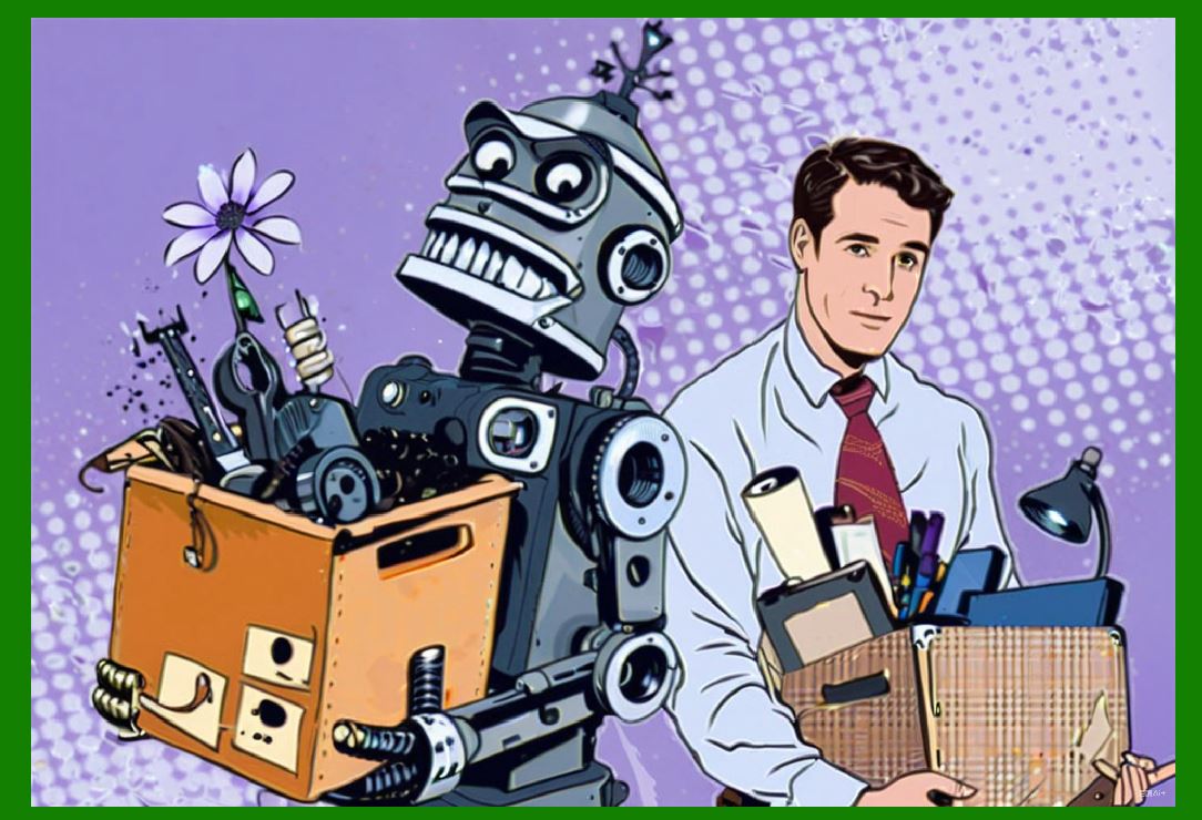
Autonomous robots replace some tasks, but they also create new jobs. Humans are needed to design, build, deploy, maintain, and supervise robots. In many cases, robots work alongside humans rather than replacing them. |
14.4 'SLAM Works Everywhere' |
SLAM works well in many environments, but not all. Environments with few features, such as long empty corridors, are challenging. Environments with extreme dust or fog are challenging. Environments with highly dynamic objects are challenging. Multi-sensor fusion helps, but no system is universal. |
14.5 'Autonomous Mobility Is Only for Large Companies' |
Autonomous mobility is becoming more affordable. Small and medium-sized companies are adopting AMRs for specific tasks. Cloud-based fleet management and robots-as-a-service models reduce upfront costs. |

|
15. Best Practices |
Based on experience across industries, several best practices have emerged. |
15.1 Start with a Clear Use Case |
Define the problem you want to solve. Is it labor shortageSafetyAccuracyEfficiencyA clear use case guides sensor selection and system design. |
15.2 Choose the Right Sensors |
Match sensors to the environment. Lidar for geometry. Cameras for recognition. Radar for all-weather. Ultrasonic for close range. IMU and encoders for motion. Use multiple sensors for redundancy. |
15.3 Map Carefully |
Create a good initial map. Clean it up. Annotate it with important locations. Keep it updated as the environment changes. |
15.4 Plan for Safety |
Use safety-rated sensors and redundant systems. Conduct a risk assessment. Train workers. Test thoroughly. |
15.5 Integrate with Existing Systems |
Connect the robots to your warehouse management system, manufacturing execution system, or hospital information system. Integration maximizes value. |
15.6 Monitor and Maintain |
Monitor robot performance. Track uptime, battery life, and errors. Perform regular maintenance. Update software. |
15.7 Scale Gradually |
Start with a pilot. Learn from it. Expand as you gain confidence. Scaling gradually reduces risk. |

|
16. Detailed Summary |
This chapter has explored autonomous mobility with a focus on multi-sensor SLAM. The following is a detailed summary of the key points. |
16.1 The Core Idea |
Autonomous mobility allows robots to move without human drivers. SLAM, or Simultaneous Localization and Mapping, is the technology that makes this possible. SLAM lets a robot build a map of its environment while simultaneously tracking its own position within that map. Multi-sensor SLAM uses several types of sensors, such as lidar, cameras, radar, ultrasonic sensors, IMUs, wheel encoders, and GPS, to improve accuracy and robustness. By fusing data from multiple sensors, the robot can cross-check information, handle sensor failures, and adapt to changing conditions. |
16.2 How It Works |
The process begins with initialization and mapping. The robot collects data, preprocesses it, extracts features, associates data, estimates its state, builds a map, closes loops, plans paths, avoids obstacles, and executes motion. This cycle repeats continuously. Multi-sensor fusion occurs at every stage. Calibration and synchronization are essential. Challenges include dynamic environments, computational load, sensor degradation, and safety certification. |
16.3 Applications |
Autonomous mobility is used across many industries. In manufacturing, AMRs transport parts and materials. In warehousing and logistics, AMRs move shelves, pallets, and totes. In healthcare, robots transport supplies and medications. In agriculture, robots navigate fields and orchards. In mining and construction, robots operate in dangerous environments. In ports and airports, robots move containers and baggage. In retail and hospitality, robots scan shelves, clean floors, and deliver items. In public spaces, robots clean and deliver packages. In space and underwater, robots explore and map. Each application benefits from multi-sensor SLAM. |
16.4 Benefits |
The benefits include labor savings, accuracy, safety, flexibility, scalability, and data collection. Robots work around the clock without breaks. They follow routes precisely. They handle dangerous tasks. They adapt to layout changes. They can be scaled by adding more units. They collect data that can improve operations. |
16.5 Implementation |
Implementation requires environment assessment, map creation, fleet management, integration, training, maintenance, and cost-benefit analysis. Starting with a clear use case and scaling gradually are best practices. Safety standards such as ISO 3691-4, ISO 13482, ISO 10218, and ANSI/RIA R15.08 guide design and operation. |
16.6 Future |
The future of autonomous mobility includes better sensors, edge computing, 5G and private networks, cloud robotics, human-robot collaboration, standardization, and sustainability. These trends will make robots more capable, more affordable, and more widespread. |
16.7 Final Thoughts |
Autonomous mobility is not a distant dream. It is here, working in factories, warehouses, hospitals, farms, mines, ports, stores, and cities. Multi-sensor SLAM is the engine that drives it. By combining lidar, cameras, radar, ultrasonic sensors, IMUs, wheel encoders, and GPS, robots can navigate complex, changing environments safely and reliably. The technology is still evolving, and challenges remain. But the direction is clear. Autonomous mobility will play an increasingly central role in industrial operations and in daily life. For engineers, managers, and students, understanding SLAM and multi-sensor fusion is essential. For society, the benefits of safer, more efficient, and more flexible mobility are too great to ignore. The robots are already on the move. The task now is to guide their development wisely and to deploy them responsibly. |
 cs@easiersoft.com